Showing posts with label Hiking. Show all posts

Sogging Through Sourland Mountain


Sourland Mountain is a 17-mile ridge that runs from the Delaware River in Lambertville, NJ to Hopewell Township. It boasts the largest contiguous forest in Central NJ (about 90 square miles). There is not much elevation gain as the highest point is only 568 feet above sea level. 
 
View from the parking lot
It is part of the 4,000-acre Sourland Mountain Preserve that offers hiking, mountain biking, bird watching, bouldering, and horseback riding, according to SomersetCountyParks.org. It is also known for its nesting birds, including Black-capped and Carolina Chickadees, Winter Wrens, and Summer Tanagers.

Early on the trail
We had dinner plans that evening, so it was a quick way to get in a short hike.   Due to rain earlier in the week, the trail was extremely muddy. We decided to hoof down in an open area (it looked like a hill minus the high tension wire), where we counted tons of praying mantis oothecas, the protective capsule that houses the egg mass during metamorphosis.

Praying mantis waiting to be born
We were met by a jovial fellow who looked to be in his late 70s or early 80s who was wearing a pair of army green knickers, wool socks, and a very bright red sweater. I was confused because I heard the sound of opera music, but my iPod was playing a rock playlist.  I realized the sprightly old gent was carrying an external speaker and the music was coming from it. I wanted to ask if I could take his picture, but thought it might be rude. So we bid him farewell and completed out descent.

Watch where you walk on the way to your car because the grass around the pond at the bottom of Sourland Mountain is inundated with goose poop, which is very difficult to clean from your hiking boot treads. Plus it's not the nicest way to end a good day.

Heidi’s rating: ★ Nice, but definitely not the most exciting hike.
The Fat Man’s rating: 3 mud pies.

The Brown Mile (Pine Barrens)


The Pine Barrens, or Pinees as we New Jerseyites called them, is a flat area of land that spans more than seven counties in southern New Jersey. It is sometimes referred to as the Pinelands. 

Friends of ours were winter camping at Brendan T. Byrne State Forest campground. It was mid-February and while the Fat Man is known to enjoy sleeping on the snow, I do not camp outdoors until Memorial Day. Even then it is often chilly enough at night to don a wool cap, gloves, and want to stay put in your 20-degree sleeping bag.

It took us about 90 minutes to drive there and we had some trouble finding the campground (look for Mile Marker 1 Highway Route 72 East). Brendan T. Byrne State Forest boasts more than 25 miles of marked trails.


When we arrived, our friends were still finishing their breakfast. It was very damp and bitterly cold, despite a blazing campfire. Thank goodness for my North Face down jacket, which the Fat Man delighted me with one Christmas several years ago.

Right before we headed out, it started to rain, which is a bit of a bummer when you are hiking. Fortunately, it cleared up within the hour.

We started off by walking around a lovely, little pond that looked like a Monet painting with the early morning mist. From that point forward, however, the hike was reminiscent of our Green Tunnel adventure in New Hampshire (except this time the road was brown). Most of the time, we were totally encompassed by pine trees. The path was uneven at times, due to mounds of sand. It reminded me of the beaches of Cape Cod (for about 10 seconds), which holds lovely memories for the Fat Man and I because we honeymooned there nearly 16 years ago.
Pinelands
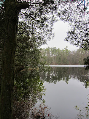
Pine Barren Pond


Heart of the Pine Barrens

Despite the complete lack of elevation, by the time we got back to the campsite several hours later, several of us were exhausted (mostly me). While it was a good conditioning workout, I quickly grew bored by the monotony of the landscape. Perhaps if the sun had been shining, the birds had been chirping, and it was 50 degrees warmer, I might have felt differently. It was even colder and damper later that day and I was never so happy to hop into Horace the Honda and turn on the heat.

Picnic area
On the ride back, we stopped at the Collingswood auction and flea market (on State Highway number 33 and State Highway), which we will definitely go back to when the weather gets warmer. It is on 25 acres of land and offers more than 500 outdoor merchants (only 30 or so braved the outdoors in February) and a 60,000 square foot building which houses 100 indoor tables and booths. It also includes an awesome product stand for fresh fruits and vegetables. 

Heidi’s rating: for the hike and ★ ★ ★ for the flea market.
The Fat Man’s rating: 3 pine cones.

Round Valley Winter Land


Round Valley is a delightful man-made reservoir in Clinton Township, New Jersey, which was built in 1960 by the New Jersey Water Authority. It is a valley surrounded by Cushetunk Mountain and spans 2,000 acres. It offers hiking, swimming, motor boating (up to 10 horsepower only), kayaking, canoeing, fishing, picnicking, camping, mountain biking, cross country skiing, sledding, and snowshoeing.

Round Valley Reservoir

It is one of many little gems that are close to our home. We have it all here in New Jersey: cliffs and mountains, farmland, beautiful ocean beaches, lakes, rivers, and more. Most visitors only see the worst part of New Jersey, which is by Newark airport and close to New York City. Go west or south and you understand why it is called the Garden State.

The water at the reservoir is quite deep (180 feet) and you have to be careful. We have a little, pimped-out boat I bought for the Fat Man and always wear our life preservers. It is New Jersey’s version of the Bermuda Triangle because more than two dozen people have drowned there (one boater just perished last week, in fact). Several bodies have never been found. Morbidity aside, going there is like taking a mini-vacation.

The "beach"
It was early February and we were hit with a snowstorm that left several inches of soft powder on the ground. Since Round Valley is just minutes away, we thought it would be nice to get outside for a bit. I wanted to bring my snowshoes, but the Fat Man talked me out of it. I regretted it — and will listen to my intuition next time — because the snow was much deeper on the trail than at home.

In the woods


There are three marked trails to choose from at Round Valley: the nine-mile Cushetunk Trail (which leads to the campsites), the one-mile looped Pine Tree Trail, and the Family Hiking and Biking Trail. We chose the Pine Tree Trail, but went off-piste, which is when those snowshoes would have come in handy.

Little slice of heaven
After an hour of walking in the woods, we headed over to one of the steep sledding hills (the best one is on the right hand side near the entry gate to the park).  It was packed with people of all ages and it was a real hoot to watch some of the train wrecks.

Admission to Round Valley is free during the off season. Entrance fees are charged from Memorial Day weekend through Labor Day (see their website for details).
 

Heidi’s rating: ★ ★ ★ ★ for pristine winter beauty.
The Fat Man’s rating: 4 Flexible Flyers and a sticker bush.