Today is our last day in
New Hampshire so the Fat Man and I wanted a trail that didn’t involve a long
car ride from Madison. We chose the
Champney Falls Trail, which is off of the Kancamagus Highway in Albany, NH (10
miles west of Conway).
We took the loop trail,
which from start to finish is 3.5 miles.
 |
| Trailhead |
 |
| The early part of the trail |
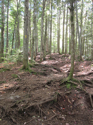
The trail is well marked with yellow blazes. The terrain varies along the way.
 |
| Follow the yellow blazes |
 |
| Rocky spots |
Like so many other New Hampshire trails, the bridge was wiped out by heavy rain from storms like Irene.
 |
| You have to cross the stream |
 |
Exposed tree roots |
The total elevation is 600 feet. The first 45 minutes were a gradual ascent. I felt like a gazelle going up. The Fat Man was well behind me (but he had some snickerdoodle cookies the night before, which can slow you down). I am trying my best to avoid processed foods with sugar.
 |
When we got to the sign for the falls, we went left. I don’t like heights so I was glad we took this route. I find it is much easier going up when I don’t have to look down.
 |
| We went left here |
 |
| View from the lower falls |
We then climbed up the rocks and rock stairs to the top of the falls. It was steep and a little wet, which is why it carries a moderate rating.
 |
| View from on high |
The path down had a ledge and narrow area that made me a little uncomfortable (I really wish I didn't have acrophobia). But as I like to say, “there is no shame in shimmying.” I just sat down on my haunches and slid my way down.
All in all it was a lovely
trail and a great way to end a wonderful vacation. Our goal is to continue hiking and get into better shape to continue on this trail to Mount Chocorua.
Heidi’s rating: ★★★ only because I don’t like steep areas
The Fat Man’s rating: 2 packs of Peanut Butter Tandytakes (the original
spelling) and a glass of milk


No comments:
Post a Comment